
-
Popular Now
-
-
Similar Forum Topics
-

-

-
 By quadcrazy
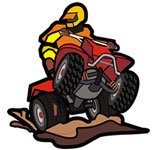
Mud riding is one of the most popular forms of ATV riding, but the wrong tires can leave you stuck fast in deep ruts and swampy trails. Choosing the best ATV tires for mud can dramatically improve traction, steering control, flotation, and overall off-road performance.
Whether you ride trails, mud parks, swamps, or backwoods terrain, this guide covers some of the top ATV mud tires available today and what makes them stand out.
What Makes a Good Mud ATV Tire?
Mud tires are designed with aggressive tread patterns and deep lugs that help clean out thick mud while maintaining traction. The best mud tires usually feature:
Deep tread lugs Wide spacing for self-cleaning Strong sidewalls Taller tire sizes for added clearance Durable construction for rough terrain 1. Maxxis Zilla
The Maxxis Zilla is one of the most popular ATV mud tires because it balances mud performance with trail comfort. It is lightweight, aggressive, and performs well in a variety of terrain conditions.
Why Riders Like It
Excellent mud clean-out Lightweight design Smooth trail ride Available in many ATV sizes Best For: Trail riders who also spend time in mud.
2. ITP Cryptid
The ITP Cryptid is designed for serious mud riding with deep tread lugs and strong sidewall construction. It provides excellent traction in deep mud while remaining durable on rough trails.
Features
Deep aggressive tread 6-ply durability Strong side bite traction Great for lifted ATVs Best For: Deep mud and swamp riding.
3. Outlaw 2 ATV Tires
The Outlaw 2 has become a favorite among hardcore mud riders thanks to its massive lugs and impressive pulling power in thick mud.
Pros
Extreme mud traction Large tread design Excellent forward bite Popular in mud parks Cons
Rougher ride on trails Heavier than trail-oriented tires Best For: Dedicated mud machines and mud bogs.
4. STI Out & Back Max
The STI Out & Back Max offers a solid balance between aggressive mud performance and everyday trail comfort.
Highlights
Durable sidewalls Great traction in loose terrain Smooth handling Long tread life Best For: Utility ATVs and hunting machines.
5. SuperATV Assassinator
The Assassinator is built for extreme mud riding and features huge paddle-style lugs capable of digging through the nastiest swamp conditions.
Features
Massive tread depths Extreme mud traction Available in oversized setups Designed for hardcore mud riders Best For: Extreme mud builds and dedicated swamp riders.
Choosing the Right Mud Tire Size
25-27 Inch Tires
Great for stock ATVs Less drivetrain strain Better acceleration 28-30 Inch Tires
Balanced performance More ground clearance Popular for trail mud riding 32+ Inch Tires
Maximum mud performance Best for lifted ATVs Ideal for deep swamp riding Larger tires may require clutch upgrades, lift kits, or gear reductions depending on your ATV.
Bias vs Radial Mud Tires
Bias Ply Tires
Stronger sidewalls Better puncture resistance Popular for aggressive mud riding Radial Tires
Smoother ride quality Improved handling Better trail comfort Most serious mud riders prefer bias-ply tires because of their durability in harsh terrain.
ATV Mud Tire Maintenance Tips
Wash mud off after every ride Check tire pressure regularly Inspect sidewalls for damage Rotate tires periodically Avoid excessive pavement riding Lower tire pressure can improve mud traction, but beadlock wheels are recommended for very low PSI setups.
Final Thoughts
The best ATV tires for mud depend on your riding style and terrain conditions. Riders who split time between trails and mud often prefer versatile tires like the Maxxis Zilla, while hardcore mud riders typically choose aggressive options like the Outlaw 2 or Assassinator.
Before upgrading to oversized mud tires, make sure your ATV can handle the added weight and drivetrain stress. Proper setup can dramatically improve your ATV’s performance in deep mud and swamp terrain.
Visit QUADCRAZY ATV Forum for ATV tire reviews, mud riding discussions, builds, and technical advice from fellow riders.
View full post
-
 By rjsummer
I just bought a 1984 Suzuki LT185 ATV and am looking for the OWNER’S manual. ( not a service manual)
I contacted Suzuki Canada but they have no paper or digital copies in their archives.
Does anyone possibly have a digital copy they’d be willing to share?
-
 By Callaway
I am trying to diagnose a no spark issue with my 02 Big Bear 400 and I am really hoping it is not a CDI. I have done the test on the stator and I believe that is faulty. I ordered a new aftermarket one from a the jungle website and it tested bad right out of the box so I am waiting for a different one to arrive from an ATV parts supplier. I started looking out of curiosity at CDI units and it seems if it is for a big bear you are SOL. Kodiaks, no problem. Big Bear. No such luck.
-


COMMUNITY SECTIONS
ATV FORUMS
QUADCRAZY MEMBERSHIP
Be a part of best online community of ATV riders and join thousands of people who love ATVs! Share your ATV photos, videos, ATV rides, get help with your ATV and more. Not a member?
Recommended Posts
Join the conversation
You can post now and register later. If you have an account, sign in now to post with your account.
Note: Your post will require moderator approval before it will be visible.