


joet82
-
Posts
338 -
Joined
-
Last visited
-
Days Won
1
Content Type
Profiles
Forum
Gallery
ATV Magazine
Events Calendar
Downloads
Store
Community Map
Posts posted by joet82
-
-
gotcha. course you could take the southern route and go on I-40 to I-5...that'll take you through oregon. but I'm guessing since you take I-90 that he lives in eastern WA.
Sorry to steal the thread.
-
I have never been to Oregon, but it sure looks nice!
BTW good lookin pup there!
your kid lives in wa, but you've never been to oregon?
-
She stays around camp when I take off too quick, but she followedd me once to the bathroom at pismo since I was still in sight.
I haven't taken her out for a ride, cause it'd be rather unsafe for her to ride or run with a sport quad.
But here is the best pic ever taken of her...Sitting on the Oregon Coast.

-
Sorry Bot, just had to 1 up you.
[ame=http://www.youtube.com/watch?v=rmgf60CI_ks]YouTube - Christmas Lights Gone Wild[/ame]
[ame=http://www.youtube.com/watch?v=SBsUaiYYBWM]YouTube - Animated Christmas Lights - Overture 34th Street[/ame]
-
I do, when I ride them. I only put adds into the trail section where I can give my own perspective. Sorry bot. but after my september road trip, I will hopefully be adding MANY trails nation wide.
-
I've never actually been to WV, but this is the info I got from Trailsource.com
-
Pinnacle Creek ATV Trails
NOTES: Southeast of Logan and Pineville, the Pinnacle Creek ATV Trails are part of the Hatfield-McCoy Recreation Area, a 500 mile multi-use trail system combining singletracks and fire roads on corporate-owned property. Presently, the system consists of five loops serviced by 5 restroom-equiped trailheads.
Near Pineville in Wyoming County, the Pinnacle Creek Trail System consists of 105 miles of trails across private land. The rolling trails wind along river and through dense forest on reclaimed coal mining land. The best place to start is the Castle Rock Trailhead. The breakdown in trail percentage is as follows: 44% are green trails (easiest), 35% are blue trails (more difficult), 21 percent are black trails (most difficult), and 0% are orange trails (single track only). This trail system has direct access to food, fuel, and lodging in the city of Pineville, West Virginia.
Castle Rock Trailhead Directions
Driving north or south on Rt.119, take the Logan exit (Walmart). Follow Rt. 73 east to Rt. 10. Take Rt. 10 for 45 miles to Pineville. Follow Rt. 10 South through Pineville. Turn onto Rt. 16 South. Make a left at Pinnacle Creek Road and follow signs 3 miles to the trailhead. Signage will be posted to aid your travels. (Approximately 45 miles)
Driving north or south on I-77, take the Robert C. Byrd exit near Beckley. Travel south on Rt. 16 toward Sophia 3.5 miles. Make right on to Rt. 97/54 toward Twin Falls State Park and travel approximately 12 miles. Then turn right, continuing toward Twin Falls State Park on Rt. 97. At the intersection of Rt. 97 and Twin Falls State Park entrance, make a right continuing on Rt. 97 and then driving 7 miles toward Pineville. When reaching the intersection of Rt. 97 and Rt. 10, bear left onto Rt. 10 south. Travel approximately 1 mile and turn right onto Route 16 south. Travel .5 miles then turn left following the signs for Castle Rock trailhead. Finally, drive 2.8 miles to the trailhead center which is located on the left. This trail system is located approximately 5 miles to the nearest town of Pineville.
Note: a helmet, eyewear and boots are required on the Hatfield/McCoy Trail System. Also, double riding is not permitted. The machine must be equipped with a spark arrestor and muffler. Annual, multi-day and one-day permits are available.
-
Little Coal River ATV Trails
NOTES: South of Charleston and north of Danville, the Little Coal River Trail at the Water Ways Trailhead is part of the Hatfield-McCoy Recreation Area, a 500 mile multi-use trail system combining singletracks and fire roads on corporate-owned property. Presently, the system consists of five loops serviced by 5 restroom-equiped trailheads.
When complete, the Little Coal River ATV Trail system will have 60 miles of trails. This system has the most easy trails of any part of the Hatfield-McCoy System.
To reach the Water Ways Trailhead for the Little Coal River ATV Trails: Driving north or south on SR119, take the Waterways Exit that is just north of the water park. Follow th eroad approximately 0.5 miles to the trailhead. It is about 18 miles south of Charleston and 10 miles north of the Madison/Danville Exit.
Note: a helmet, eyewear and boots are required on the Hatfield and McCoy Trail System. Also, double riding is not permitted. The machine must be equipped with a spark arrestor and muffler. Annual, multi-day and one-day permits are available.
-
Indian Ridge ATV Trails - West
NOTES: In McDowell County, the Indian Ridge Trail System is part of the Hatfield-McCoy Recreation Area, a 500 mile multi-use trail system combining singletracks and fire roads on corporate-owned property. It starts at the Ashland Trailhead and winds through the hills.
The Indian Ridge Trail System has one trailhead with a 2 acre parking area and restrooms. This trail offers a nice variety of trails for all difficulty levels. The breakdown in trail percentage for this trail system is as follows: 24% are green trails (easiest), 47% are blue trails (more difficult), 20% are black trails (most difficult), and 9% are orange trails (single track). This trail system offers community access to the Town of Norhfork and the Town of Keystone.
The Ashland Trailhead of the Indian Ridge Trail System is located a short distance from I-77 near Princeton and Bluefield West Virginia. Driving north or south on Interstate-77, take Exit 1, follow truck route US 52 N through Bluefield to US 52 North 26.3 miles to Northfork, make a sharp right turn North onto Country Road 17 (Northfork-Ashland Road). Continue on County Road 17 another 6.5 miles to the entrance of the Ashland Trailhead.
-
Indian Ridge ATV Trails - East
NOTES: In McDowell County, the Indian Ridge Trail System is part of the Hatfield-McCoy Recreation Area, a 500 mile multi-use trail system combining singletracks and fire roads on corporate-owned property. It starts at the Ashland Trailhead and winds through the hills.
The Indian Ridge Trail System has one trailhead with a 2 acre parking area and restrooms. This trail offers a nice variety of trails for all difficulty levels. The breakdown in trail percentage for this trail system is as follows: 24% are green trails (easiest), 47% are blue trails (more difficult), 20% are black trails (most difficult), and 9% are orange trails (single track). This trail system offers community access to the Town of Norhfork and the Town of Keystone.
The Ashland Trailhead of the Indian Ridge Trail System is located a short distance from I-77 near Princeton and Bluefield West Virginia. Driving north or south on Interstate-77, take Exit 1, follow truck route US 52 N through Bluefield to US 52 North 26.3 miles to Northfork, make a sharp right turn North onto Country Road 17 (Northfork-Ashland Road). Continue on County Road 17 another 6.5 miles to the entrance of the Ashland Trailhead.
-
Dingess Rum ATV Trails
NOTES: East of Logan and Stollings, the Dingess Rum ATV Trails at the Bear Wallow Trailhead is part of the Hatfield-McCoy Recreation Area, a 500 mile multi-use trail system combining singletracks and fire roads on corporate-owned property. Presently, the system consists of five loops serviced by 5 restroom-equiped trailheads.
The Dingess Rum / Bear Wallow trail system has 125 miles of trails.
To reach the Bear Wallow Trailhead for the Dingess Rum ATV Trails: Driving north or south on Rt. 119, take the Logan exit (Walmart). Follow Rt. 73 east to Rt. 10 south. Pass the town of Logan and make a left onto Rt. 17 north. Go under the train tressel (Only 9' high). Make a left onto Red Campbell Road at the Wanda Trailer Park. Make the second right and follow the road to the trailhead center. If you cannot fit under the train tressel, make a left (across from the Logan Professional Building) onto Rt. 17 truck route, follow the signs to Rt. 17 north and make a left.
Note: a helmet, eyewear and boots are required on the Hatfield and McCoy Trail System. Also, double riding is not permitted. The machine must be equipped with a spark arrestor and muffler. Annual, multi-day and one-day permits are available.
Important: before riding this trail area, make sure to contact the local land manager regarding current registration, equipment and gear requirements. Also, verify open/closure dates and times.
-
Buffalo Mountain ATV Trails
NOTES: Southwest of Logan and east of Williamson, the Buffalo Mountain ATV Trails at the Reverend Compton Trailhead is part of the Hatfield-McCoy Recreation Area, a 500 mile multi-use trail system combining singletracks and fire roads on corporate-owned property. Presently, the system consists of five loops serviced by 5 restroom-equiped trailheads.
The Buffalo Mountain / Reverend Compton Park system has 95 miles of trails.
To reach the Reverend Compton Trailhead for the Buffalo Mountain ATV Trails: From Rt. 119, follow Rt. 52 south through Williamson. The trailhead center is eight miles outside of Williamson. The town of Matewan (depicted on the trail map) allows motorized trail users to ride into town. Please ride responsibly and obey all road rules. Twenty minutes from Williamson. Forty-five minutes from Bearwallow and Rockhouse Trailheads.
Note: a helmet, eyewear and boots are required on the Hatfield and McCoy Trail System. Also, double riding is not permitted. The machine must be equipped with a spark arrestor and muffler. Annual, multi-day and one-day permits are available.
Important: before riding this trail area, make sure to contact the local land manager regarding current registration, equipment and gear requirements. Also, verify open/closure dates and times.
-
Browning Fork ATV Trails
NOTES: Southeast of Logan and just south of Man, the Browning Fork ATV Trails at the Rockhouse Trailhead is part of the Hatfield-McCoy Recreation Area, a 500 mile multi-use trail system combining singletracks and fire roads on corporate-owned property. Presently, the system consists of five loops serviced by 5 restroom-equiped trailheads.
The Rockhouse / Browning Fork system has 115 miles of trail.
To reach the Rockhouse Trailhead for the Browning Fork ATV Trails: Driving north or south on Rt.119, take the Logan exit (Walmart). Follow Rt. 73 east to Rt. 10. Take Rt. 10 for 16 miles to Rt. 80 south. Bear right onto Rt. 80, cross the bridge and the railroad tracks. Cross the river and make a left at the stop sign. Follow the road approximately ½ mile to the trailhead center.
Note: a helmet, eyewear and boots are required on the Hatfield and McCoy Trail System. Also, double riding is not permitted. The machine must be equipped with a spark arrestor and muffler. Annual, multi-day and one-day permits are available.
Important: before riding this trail area, make sure to contact the local land manager regarding current registration, equipment and gear requirements. Also, verify open/closure dates and times.
FOR MORE INFORMATION: HMRA (800) 592-2217; WV Tourims (800) CALL-WVA; Tug Valley Tourism (304) 235-5240; Coalfield Tourism (304) 792-8519; Hatfield-McCoy Reservations (304) 369-7260
-
There is a boy popping in to say hello and welcome.
Careful Bot, you may get in trouble with the wifey for popping in here and just saying hi.
-
basically like what can am did this year.
-
5 quads and an otv fit inside the transport? HOW? lol
-
no u couldn't Bot, stop lying to yourself.
-
Dirtdog just posted this on SWR......
Kids Racin around camp......
Garrett Starts them off.....
pismo10-08048.flv - Video - Photobucket - Video and Image Hosting
Were they playing 'Bump-to-Pass'? lol
-
I'm assuming since you're asking, you don't have an owners manual?
-
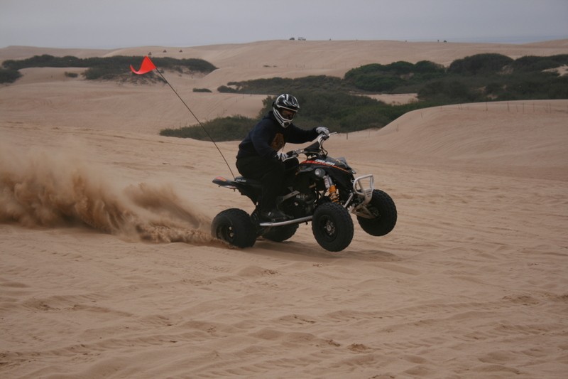
I think it's the 400. if it was the 800, it might have pulled me out. haha
-
This is a video that Raptor8 made for Kristin and I. This was in Bend, Or while on our honeymoon.
Bot and Kristin on a ride in Oregon Video » QUADCRAZY ATV Community
Thanks again Paul!
Hopefully one of these days we'll have a video, or at least a pic of these 3, myself, MWKE, DirtDog and many more.
-
AND,,,,,,It can be towed in the Sand my a Grizzly 700.....But not the Can-Am 450 or whatever the heck it is......
Just Tryin to help sales Joe:laugh:
it was the can am outlander that was having the problems. kinda hard for the DS450 to tow it since it was in the trailer.
-
Obama Wins!
And you were saying Bush put this country in the gutter....lets see where it goes now.
-
Thnx Wheeler, I have the only one on the west side of the Rockies.
sadly I have to sell it since i'm getting a toy hauler. $5000. Still looking for takers.

2009 Riding Trips
in Where To Ride Your ATV
Posted
I'm planning a couple road trips next year. one in february, and the other in september, but the banks aren't being nice to me in giving me a loan for the RV that I'm wanting to get.