
mikeexplorer
-
Posts
884 -
Joined
-
Last visited
-
Days Won
103
Content Type
Profiles
Forum
Gallery
ATV Magazine
Events Calendar
Downloads
Store
Community Map
Everything posted by mikeexplorer
-
I use Corel Videostudio, years ago it used to be made by Ulead. Since I have had the software for years, upgrades have been cheaper. The video I posted of the drone from Snow Shoe was done with that program. The drone is my brother's, but I bought one now and plan to use it for some exploring and fun. Only flew it a few times to get used to it. Seems everytime I have days off from work the weather is no good for flying. Scored a good deal on the drone. Mike
-
The only Black Friday shopping I did was I got an offer from Corel for an upgrade on my video editing software package which I bought and downloaded the upgrade. There are new motion and video effects that were 90% off normal price so I will be eager to try these out. On my work days now so Ill install in a few days and try it out Mike
-

Question about trailer tires
mikeexplorer replied to marek porowski's topic in ATV Trailers, Haulers, and Attachments
Two of my trailers use Loadstar tires and they work well. Mike -
Happy Thanksgiving everyone
-
1999 Artic Cat 500 ATV bogs down and backfires
mikeexplorer replied to Bruce Madsen's topic in Arctic Cat ATV Forum
Valves that are out of tolerance is another issue with backfiring. Usually the ATV is hard starting as well. Mike -
I had to do the seat on my old quad a few years back and found the material at a local craft store.
-
Oh yeah ive seen from your posts your really into restoring machines. Probably make a few bucks from it too. I have only gone as far as doing most of my own maintenance work on our machines. Some things I do take it to the dealer for as I don't have a ton of tools and for the rare occasion of something I can't deal with I just let them fix it. I get good deals from him since I bought three machines from him and I buy most of my parts from him. Mike
-
Gander is closing all stores. The one by me has a massive sale on. Mike
-
The "first" for anything always seems to hold some meaning. I still remember buying my first quad. Had it for 10 years and put a pile of miles on it. Sold it and it was reborn as a different machine now. Even other "firsts" for my other hobbies I still remember. Mike
-
What do you use to clean your ATV?
mikeexplorer replied to Frank Angerano's topic in General Talk - Anything Goes!
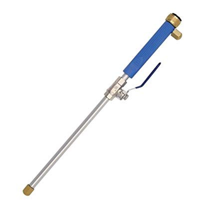
It holds the spare nozzle. You get two nozzles with it, one is a pinpoint stream, the other is a flat stream which is the one I use for washing the machines. Mike -
What do you use to clean your ATV?
mikeexplorer replied to Frank Angerano's topic in General Talk - Anything Goes!
Spray bottle, the water jet has no means to attach a soap line. -
What do you use to clean your ATV?
mikeexplorer replied to Frank Angerano's topic in General Talk - Anything Goes!
I use a water jet, attaches to the garden hose and gives a nice spray, not as powerful as a pressure washer, but more then just a regular sprayer. As far as soap Arctic Cat makes a spray and rinse cleaner that works well. I have used purple power as an alternate. Mike
-
I have the mount that puts the unit right on the handlebar. I can see it fine while riding. Mike
-
Most common thread pitch for metric bolts will be 1.25 You can also just buy an assortment kit of metric bolts at an auto parts store and can see which one actually fits. Then you will have the size and pitch. Mike
-
My first trailer project.
mikeexplorer replied to Frank Angerano's topic in ATV Trailers, Haulers, and Attachments
I overhauled my smaller trailer last year. The mesh deck was broken in several places and was getting rusty. Replaced the wiring harness and put in all new LED lights. The main difference is the deck is HDPE plastic sheet that I had cut up at work. It did add some weight but it will never rot.
-
Good it was simple. If the machine is going to sit for awhile, I use sta-bil to keep the ethanol from fouling up the machine. Mike
-
If you want to check valve clearances you can download the service manual for free here https://support.countrycat.com/?home_feed=feed&order_by=recent&taxonomy_59981_taxa=78b1c963-9296-4d06-a420-3a0114241c4f I would also suspect there was some bad gas in the tank, gas goes bad with the ethanol. Mike
-
Got out to do a little hunting set up.
mikeexplorer replied to Frank Angerano's topic in Hunting, Camping, & Outdoors Forum
Happy Hunting! Looks like you got some nice deer to choose from Mike -
Utah National Parks Will Open To ATVs
mikeexplorer replied to ATVNetwork's topic in ATV News, Articles & Press Releases
Take a look at their ATV trail system! Wow! http://www.atvutah.com/southern/paiute.htm -
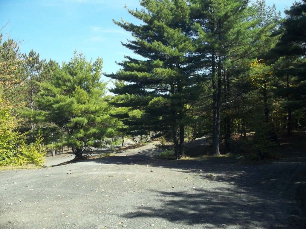
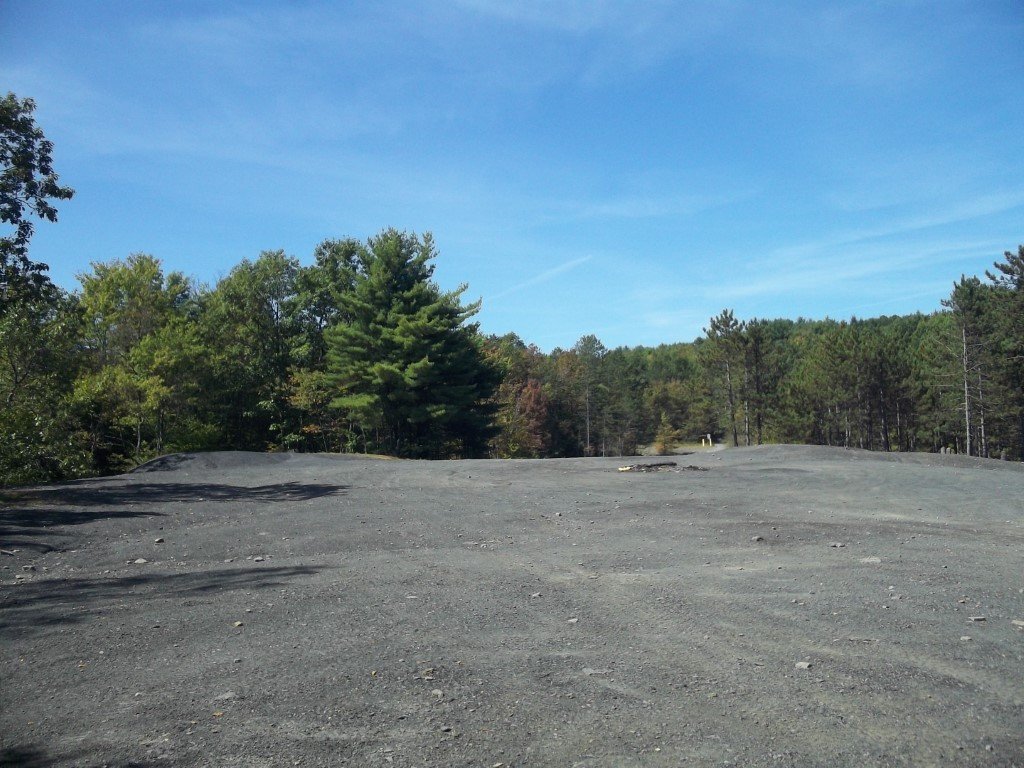
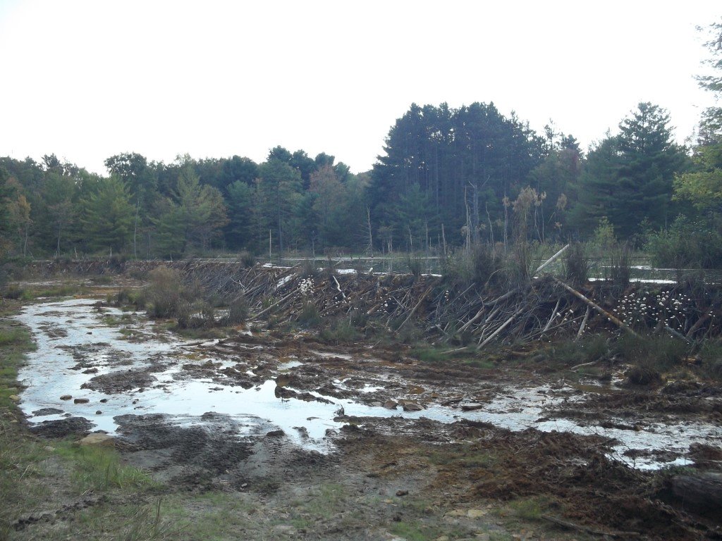
My brother is the one who owns the drone. I took the raw video files and made this video from it. Nearby is a 400 foot beaver dam, got some drone video of it as well since you can't see the whole thing from the ground
-
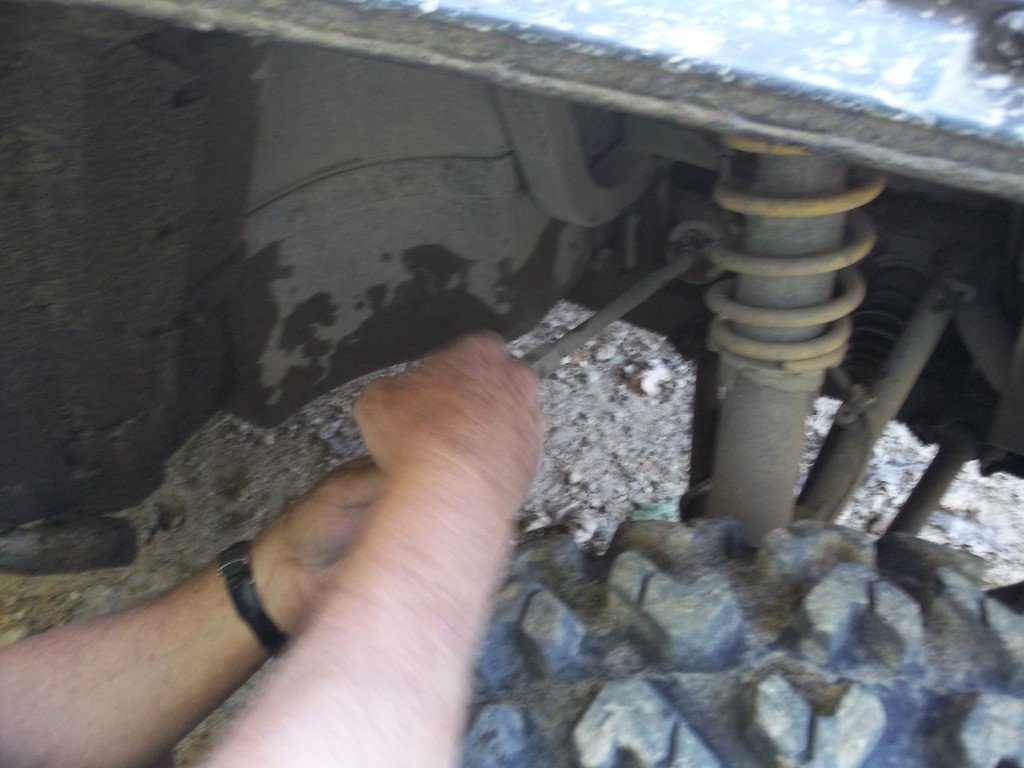
We had one breakdown on Friday, a Can-Am broke a tie rod end, we zip tied it up and rode the roads back to camp. We cooked out on the trail for lunch and stopped at a local place on the quads for dinner. The pulled pork was excellent. For Saturday night, I ran down on the quad and picked up pizzas so we ate pizza around the campfire. When I stopped to pick up the pizza's I noticed grease sling by the front shaft. It has quite a lot of play and the front U joint is shot. So the only thing we missed out on is we usually ride a few hours on Sunday before heading home. The main rides were Friday & Saturday so it was not a big loss. Dropped the quad off at the dealer yesterday, I can do most mechanical work on the quad, but not everything since I don't have a ton of tools. So for something like this that is kinda rare to happen, let the dealer take care of it. His labor price is very reasonable and he had replaced the U joint before, so he will give me a break on this repair since it is the second time.
-
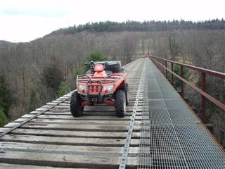
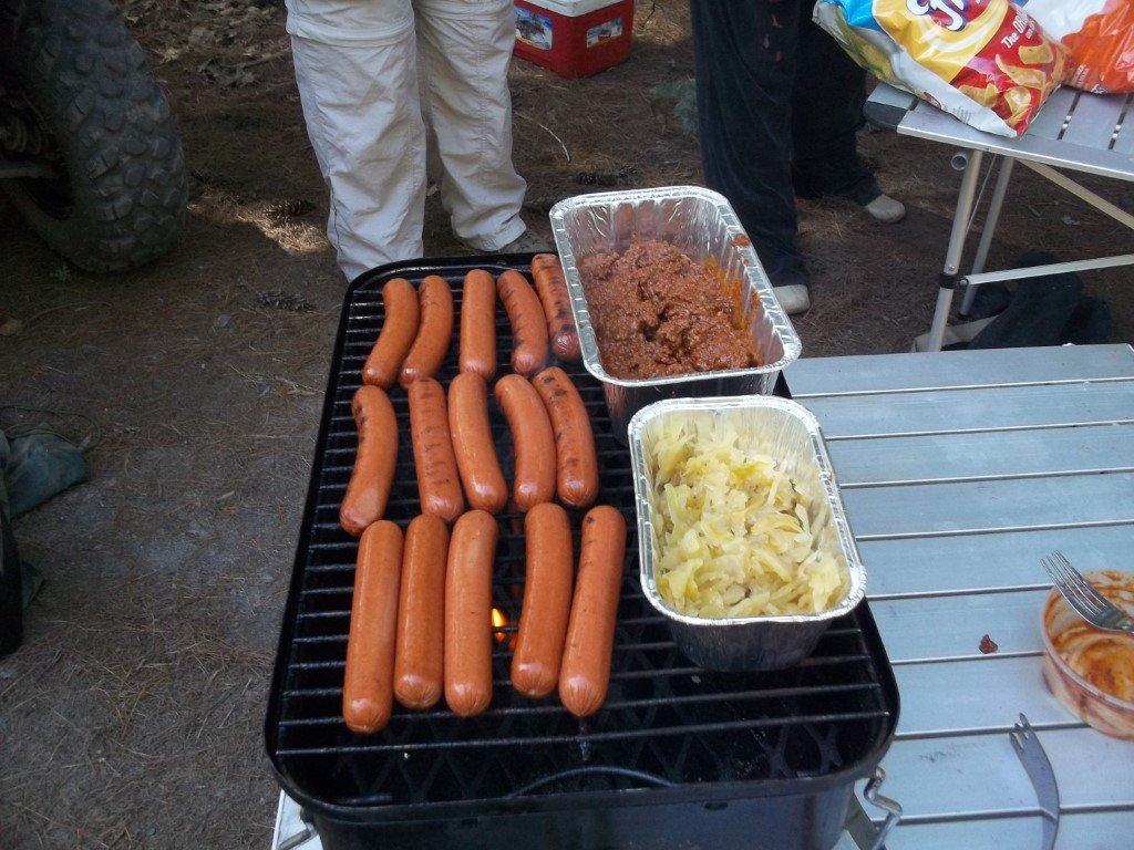
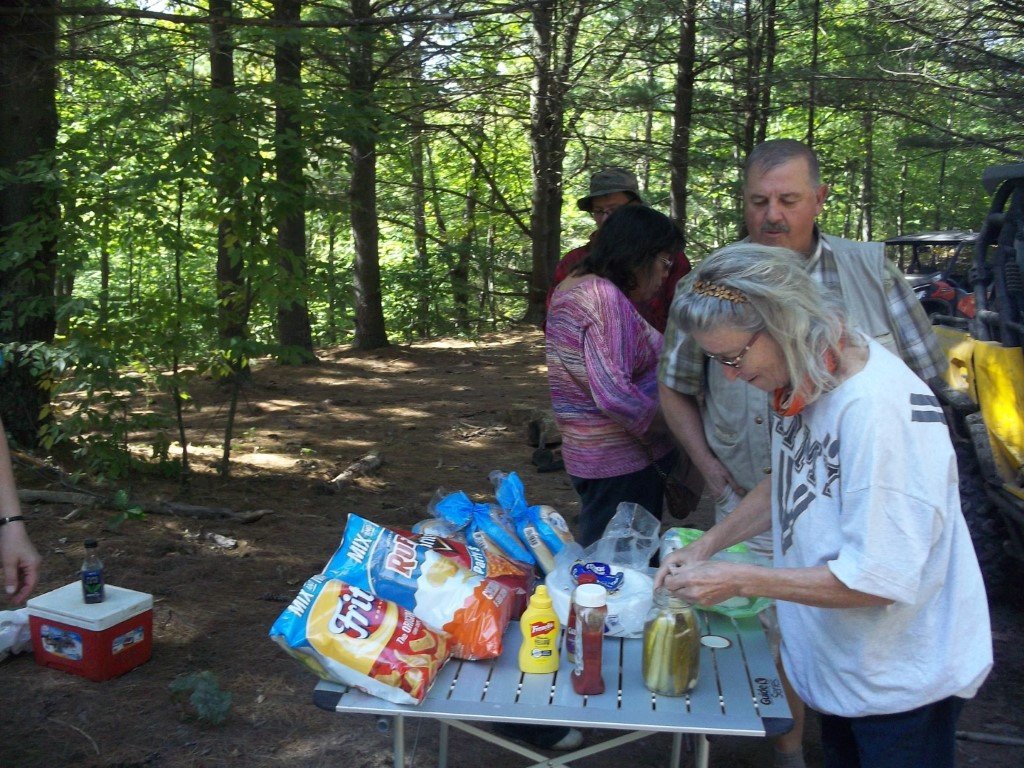
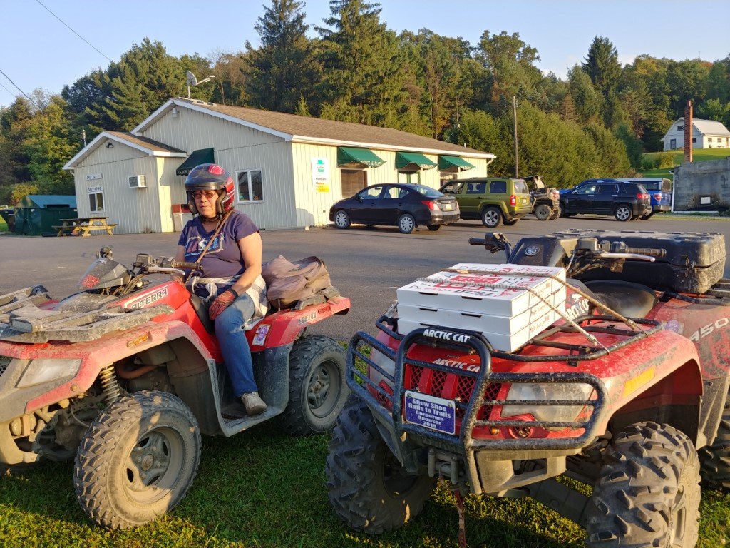
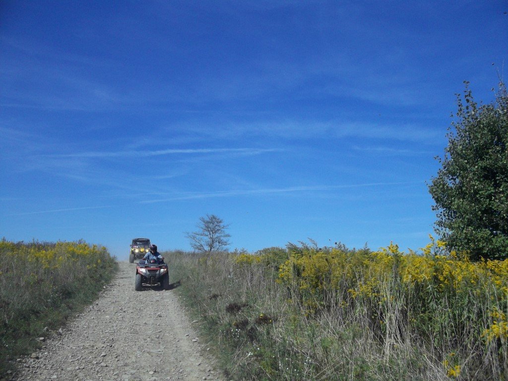
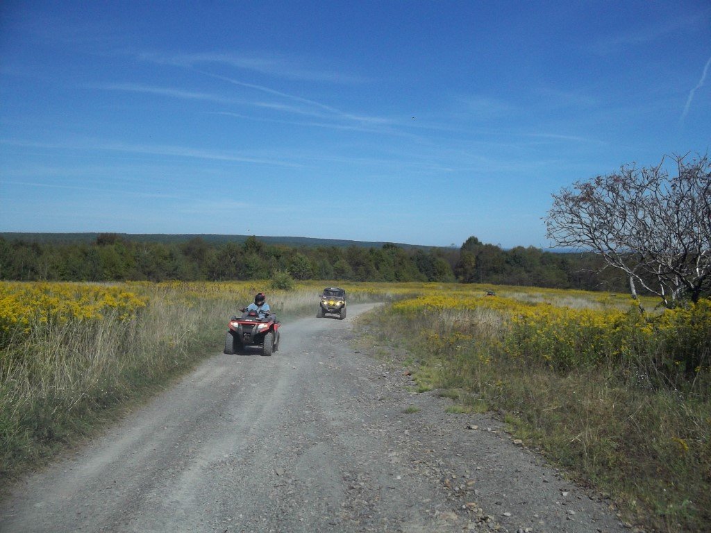
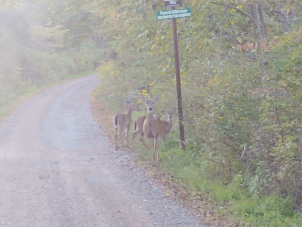
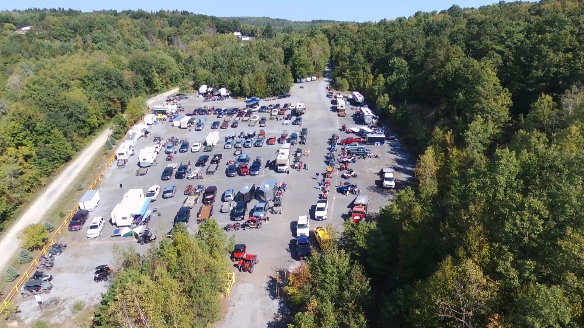
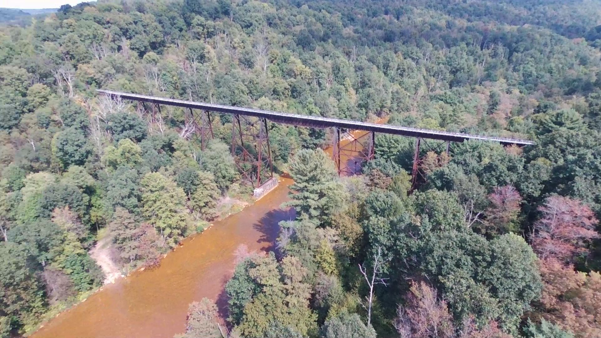
Another great weekend at Snow Shoe Rails to Trails for their annual pig roast. Thursday and Friday nights were quite cool at night. We run a buddy heater in the tent to keep warm. One of our members brought a drone and was able to get some cool video. Ill have to put it together and upload it to Youtube. They were sold out of food by 2:15pm. Trailhead was packed and they had to use two overflow areas for parking. I took a few snapshots from the drone video. One is a railroad viaduct that a few years ago we were able to cross it on our quads. It has been closed for a few years now.
-
This is a great ATV poker run.
-
That is cool.
-
Honda is the greatest ATV builder in history - fight me
mikeexplorer replied to MarkinAR's topic in General ATV Discussion
The older 650 V2 cats were Kawasaki motors, I think they were produced from 2004-2007. My first machine was a 2007 400 which had the Suzuki motor. I beat the snot out of that machine and sold it with 16,000 miles on it to a friend for parts, The upper frame was going and the lower frame was already welded twice. At 14,000 miles I sunk it good in a mud hole and it started burning oil like crazy. Dealer rebuilt the motor, Ran it for another 2,000 miles before selling it. He took the motor and transplanted it into a 2006 400 TRV which they guy who owned it blew up the motor at 800 miles (what he did was not known, but the quad was in pristine condition) The rest of the parts he kept. All 4 axles were good, both diffs, and the 4WD worked perfectly. I could not use these parts because my 2012 has a different assembly so the axles and such are different. They did not have any issues with the suzuki motors, they just switched production to their own motors, known as the H1 and H2 motors. Then for the smaller sized models such as the 366 and Alterra, they are using Kymco motors. I have two of these machines, only issue I had common to both was the fan sensor going bad. So we have three machines total, one as a spare. Mike

.jpg.1e7b9204a1a756d7dccd623034078210.jpg)
.jpg.b3abb378c30e4518347e84b39f519312.jpg)
.jpg.0e4b4eedea2c754278326706a394e087.jpg)
.jpg.f7fdafa9030fbc1bdde2eba3e721a84c.jpg)
.jpg.277b9b41563c60a56f75a8751ad745e6.jpg)
.jpg.015cb79ed2fa8d8eaec290e35730d6ee.jpg)
.jpg.0b4a0a97c39c34d8900937bbc2020f61.jpg)